🇵🇰 - Pakistan I Roads, Motorways and Highways | Pakistan Defense Forum
Theme customizer
Revert customizations made in this style

🇵🇰 Pakistan I Roads, Motorways and Highways (1 Viewer)

Currently reading:
🇵🇰 Pakistan I Roads, Motorways and Highways (1 Viewer)

G Pakistan Economic Forum

ghazi

A Legend
Moderator
Jan 25, 2024
111,083
353


NHA declared Karakoram Highway all- weather route between China and Pakistan​

By Tahir Ali

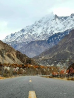
ISLAMABAD - The National Highway Authority (NHA) on Thursday declared the Karakoram Highway (KKH) an all-weather route connecting China and Pakistan.

The 806 km long KKH, which crosses challenging mountain terrain and faces harsh weather conditions and natural disasters, is the sole link between Pakistan and China through Khunjerab Pass. An official notification states, "In the context of the China-Pakistan Economic Corridor, it has been decided to ensure year-around operational status for this road."

Due to its high altitude and heavy snowfall, KKH between Sust and Khunjerab (86 km) typically becomes impassable for all traffic during the winter season from December to April each year. The notification further mentions that the Frontier Works Organisation (FWO) has already been deployed on KKH for routine maintenance under an annual maintenance contract.

An agreement between NHA and FWO has been reached to keep KKH open during the winter season between Sust and Khunjerab to all types of traffic. It is anticipated that KKH will remain accessible during the 2023-24 winter season for cross-order traffic.

Therefore, preparations will be necessary to facilitate international transit trade and passenger movement at border crossing points.
 

ghazi

A Legend
Moderator
Jan 25, 2024
111,083
353


Azad Kashmir to Skardu, a new route will be constructed through a 12.7 km long tunnel.

Pakistan's third alternative CPEC route, which will reduce 350 km distance to China's border.

The federal government has released 45 million for the Gori Kot Astore to Shagrathang Skardu road project via Azad Kashmir.

' The new route will connect China, GBK Shagar, Skardu and Astor districts to Muzaffarabad after crossing the border.

National Highway Authority (NHA) is working for the construction of Shawnter-Ratu (12.7 km long) road tunnel. (Kail to Shawnter) and (Counter to Gori Kot) roads are approximately 26.9 km and 41.5 km respectively.

This town will pass through Kail, Lower Domail, Dhaki Naka, Khora, Chatta Katha, Upper Domail and Chattian, Neelum Azad Jammu and Kashmir areas of Shawnter and Astor GB areas adjoined by Morcha Gazir, Mirmalk, Ratu, Naseerabad, Chogam, Rahmanpur and Gaurikot. Project site is about 65 km away from Astor. Way from Neelum valley to Astor valley.
 

Malang

ELITE MEMBER
Jan 5, 2022
193
75


What is the update on motorways of Pakistan. The Gwadar to Punjab motorway is complete or still under construction?

There was a motorway project from Lahore to Kharian. Is it under construction?
 

ghazi

A Legend
Moderator
Jan 25, 2024
111,083
353


N - 70 Highway ...
Eight steel bridges along the 33-kilometre long Rakhi Gaj-Bewata section of the N-70 highway, which will connect Balochistan to Punjab, has entered its final stage of completion. The project is being carried out in collaboration with Japan.

The total cost of the project, which is slated for completion in August, is Rs13.75 billion. This is the second largest project of its kind in Asia and the very first in Pakistan.

Despite payment of Sindh's share, Centre failed to finish Indus Highway project

Reportedly, in 2016, the National Highway Authority, in collaboration with Japan, initiated the project in an effort to make the hilly terrain, leading from Rakhi Gaj to Bewata, safe for commuters and traffic.

Steel is being imported for the bridges which will boast pillars taller than 150 feet. As a result of constructing these bridges and the interprovincial highway Quetta Road, residents of South Punjab will be able to easily access tourist spots in the area. This, in turn, will promote tourism at the Koh-e-Sulaiman Range.
 

ghazi

A Legend
Moderator
Jan 25, 2024
111,083
353


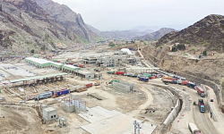
CARGO trucks pass through the Torkham area where a customs terminal is under construction.

The new terminal will have a cumulative parking facility for at least 500 vehicles which will hugely minimise traffic mess on the main Peshawar-Torkham highway.

The terminal is also designed to offer rapid passenger immigration process, efficient cargo checking and handling alongside e-lanes for even faster clearance and a sufficiently large parking space for at least 500 trucks awaiting clearance.


1707773779256.png
 

ghazi

A Legend
Moderator
Jan 25, 2024
111,083
353


Pakistan Total Road Network 493,000 kilometers.

NHA Federal road network
48 Roads..............................14480 km
13 Motorways....................... 2563 Km
32 National Highways........ 14480 Km
3 Strategic Road .....................262 Km
 

ghazi

A Legend
Moderator
Jan 25, 2024
111,083
353


National Highway ... N-70

Connecting Punjab to Balochistan

Multan (Punjab) to Qila Saifullah (Balochistan)

The National Highway 70, or the N-70, is one of the National Highways of Pakistan. The N-70 runs in between the mighty Sulaiman Mountains, lush green farmlands of Multan and Dera Ghazi Khan's districts, and you may also experience the fascinating sceneries of MusaKhel, Makhter region, and empty and beautiful areas from Loralai to Qilla Saifullah.

Its total length is 440 kilometres (270 mi) divided into 254 kilometres (158 mi) in Balochistan and the remaining 186 km (116 mi) in the Punjab.

Route
The highway starts right after the junction of N-5 in the suburbs of Multan and runs towards Muzaffargarh after crossing river Chenab and then river Indus to enter D.G Khan. After D.G Khan it starts ascending on Sulemaan range and through Girdu Pass and Fort Munro it enters in Balochistan.

The first town in Balochistan province is Rakni and then goes to Makhter region after passing long MusaKhel region and then Loralai and finally ends near Qilla Saifullah at the junction of N-50.

1707774066235.png
 

ghazi

A Legend
Moderator
Jan 25, 2024
111,083
353


NHA to link CPEC M-14 with Pak-Afghan border

The federal government has decided to connect Ghulam Khan in North Waziristan with Motorway 14 (M-14), a project of the western alignment route of China-Pakistan Economic Corridor (CPEC) via a 184km-long Motorway.

According to Gwadar Pro on Tuesday, the National Highway Authority (NHA) on Monday issued a request for proposal (RFP) of consultancy services for the Feasibility Study and Detailed Design for the Construction of the Motorway from Ghulam Khan to Esa Khel Interchange (184km approx).

The project will be financed by the Federal Government through PSDP 2022-23 through separate head/allocation.
In this regard, a pre-proposal conference on the project will be held on July 19, 2022, at NHA headquarters in Islamabad while procurement will be carried out by adopting the “Single Stage Two Envelops” procedure.

The proposals complete in all respects in accordance with the instructions provided in the RFP document in sealed envelopes, which should reach on or before August 10, 2022.

Esa Khel Interchange is located over M-14 in Mianwali district of Punjab, which is in proximity to the Lakki Marwat district of Khyber Pakhtunkhwa (KP). Between Mianwali and Ghulam Khan falls Bannu district of KP. After Torkham and Chaman, Ghulam Khan is the third most important crossing between Pakistan and Afghanistan.

Afghanistan has already started benefiting from Gwadar Port and the country received the first consignment of bulk cargo from the United Arab Emirates in July 2020. Ghulam Khan crossing, at the Pak-Afghan border point, is the shortest route connecting CPEC’s western route with Afghanistan, Central Asian States and beyond.

Feasibility Study Completed on Sept 9th: Tender issued for Feasibility Study - July 8th, 2022
Evaluation Report Completed on Nov 24th: Announcement Of Evaluation Report - Sept 9th, 2022
Current Status: TBD
 

ghazi

A Legend
Moderator
Jan 25, 2024
111,083
353


Feasibility Study, Detailed Design of Islamabad-Peshawar Motorway (2 Alignment, 189 km + 54 km=243 km)​

41.jpg


Name of associated firm : Mott Macdonald International Limited (England)
Project Location within Country:
Islamabad to Peshawar
Start Date: July 1992
Completion Date: November 1992

Project Description​

The proposed motorway connects Pakistan capital Islamabad to provincial (NWFP) capital Peshawar. Islamabad-Peshawar Motorway is a 6 lane Dual Carriageway with full access controlled facility. The length of the motorway is 154 km. Each carriageway is 0.950 M wide with 3 meters shoulders on each side and a 5 meters median. There are three major river bridges en-route over Indus River, Kabul River and Haro River.
The design of original alignment 189 km was completed in November 1992. (4 Months). The motorway was re-designed according to the GOP change of alignment (154 km) on the request of NWFP Government.

Services
  1. Route Alignment Study
  2. Feasibility Study
  3. Detailed design of motorway, Major River bridges, interchanges and wayside facilities including landscape
ECIL undertook following tasks for the above work at (1), (2) & (3).
  • Reconnaissance survey of the project area and marking route alignment on the SOP map with the assistance of satellite imagery
  • Collected and compiled socioeconomic data of the project area
  • Conducted traffic study/forecast
  • Carried out topographical surveys, identified alternate route
  • Conducted hydrological investigations also prepared hydrological & survey data for Indus River & Kabul River for Hydraulic Model Testing
  • Geotechnical & material investigations
  • Soil investigations
  • Utility surveys
  • Prepared preliminary design & preliminary cost estimates
  • Prepared economic feasibility which includes the derivation of benefit cost ratio (BCR), Internal Rate of Return (IRR), Net Present Value (NPV) and ratio of project cost for the first year benefits of the project to demonstrate the economic and technical feasibility, including testing the results of HDM model
  • Feasibility report
  • Prepared detailed design & drawings. The design and drawings were vetted by M/s. Mott Macdonald Limited (MMIL)
  • Prepared cost estimates & tender documents
 

Users who are viewing this thread

Reply